Thanks for submitting!
You will be contacted as soon as possible


CLOSE

QUICK LINKS


PROFILES
PUBLICATIONS
EXPOSURE
VULNERABILTY
SOFTWARE
EQ MODELS
Search Results
976 results found with an empty search
- SOLOMON ISLANDS EXPOSURE | Global Earthquake Model Foundation
Projects SOLOMON ISLANDS EXPOSURE Assessing the Risk Exposure of Road Network to Climate and Natural Hazard Risks in Solomon Islands Versión en español English version Share Facebook X (Twitter) LinkedIn Overview Anchor 6 Background This project aims to conduct a robust multi-hazard risk assessment of the road network to climate and natural hazards in the Solomon Islands, both historically and under future climate projections. The project includes three main dimensions: - Characterization of the climate and natural hazards - Physical vulnerability of the road network - Multi-criteria criticality analysis The three main outputs are: - Multi-hazard maps - Road network risk exposure analysis (global risk score) - Identification of "first priority" road segments and estimation of their rehabilitation costs The GEM Hazard Team supports the project by computing seismic hazard maps and uses these to produce maps to classify low to high risks of earthquake hazards, according to their intensity and frequency. Duration: 2021 Objectives Many Small Island Developing States (SIDS) share a major common feature: they are among the most exposed nations to natural hazards and climate change. SIDS are also characterized by insularity and geographic remoteness, as well as small geographic area, economies, and population, all of which increase their social and economic vulnerability. This project aims to assist the Solomon Islands to better manage climate and disaster risks by improving the understanding of risk and the use of this information for risk reduction decision-making, and the design and implementation of investments at the provincial and community level. Collaborators GEM Foundation, ARIA Technologies, Actimar, Suez Consulting, Setec Group Funding partner: World Bank Group Location Solomon Islands Anchor 1 Anchor 5 Anchor 4 Anchor3 Publications
- WESTERN BALKANS CCDR | Global Earthquake Model Foundation
Projects WESTERN BALKANS CCDR Input to World Banks' Country Climate and Development Report (CCDR) for Western Balkans Versión en español English version Share Facebook X (Twitter) LinkedIn Overview Anchor 6 Background As part of the World Bank Groups' Country Climate and Development Reports (CCDRs), the GEM Foundation and JBA Risk Management are working together to provide current (2021) and future (2050) earthquake and flood risk assessment for 6 West Balkans countries: Albania, Bosnia and Herzegovina, Kosovo, Montenegro, North Macedonia and Serbia. The GEM Risk Team is providing the exposure database (property and population data) for both the flood and seismic risk assessment for six Western Balkan countries at the lowest administrative level, using both existing datasets for 2021 and socio-economic projections for forecasted exposure to 2050. Seismic hazard and risk assessment for the current and future exposure is also being undertaken with the OpenQuake engine, leading to average annual losses and losses for specific return periods for each country. Duration: 2023 Objectives The World Bank is preparing the Country Climate and Development Report for the Western Balkans. The CCDR aims to inform policy dialogue and engagement with governments. This provides an opportunity to carry out several analytical pieces, including in the area of Disaster Risk Management, bringing together existing knowledge on the economic and social impacts of disasters and climate change, and delivering new analytical insights to support policy recommendations. Collaborators JBA Risk Management, GEM Foundation Funding partner: World Bank Group Locations Albania, Bosnia and Herzegovina, Kosovo, Montenegro, North Macedonia and Serbia. Anchor 1 Anchor 5 Anchor 4 Anchor3 Publications
- CAREC | Global Earthquake Model Foundation
Projects CAREC Developing a Disaster Risk Transfer Facility in the Central Asia Regional Economic Cooperation Region Versión en español English version Share Facebook X (Twitter) LinkedIn Overview Outreach Anchor 6 Background Willis Towers Watson, a GEM Advisor Sponsor is leading the consortium of organizations to implement the project, “Developing a Disaster Risk Transfer Facility in the Central Asia Regional Economic Cooperation Region” supported by the Asian Development Bank. The GEM Risk Team is responsible for the exposure and seismic vulnerability components of the project, with the Hazard Team providing support in the preparation of risk profiles for countries in the Central Asia Regional Economic Cooperation Region. Objectives The project has three main components: (i) development of disaster risk assessments and modeling in all CAREC countries; (ii) design of a regional pilot disaster risk transfer facility for at least three CAREC countries; and (iii) capacity building and awareness raising activities to sensitize key public and private stakeholders in all CAREC countries about the benefits of disaster risk reduction, risk retention and risk transfer solutions. Willis Towers Watson, a GEM Advisor Sponsor is leading the consortium of organizations that will implement the project. The Central Asia Regional Economic Cooperation, or CAREC Program is a partnership of 11 countries (Afghanistan, Azerbaijan, People's Republic of China, Georgia, Kazakhstan, Kyrgyz Republic, Mongolia, Pakistan, Tajikistan, Turkmenistan, and Uzbekistan), supported by 6 multilateral institutions, working together to promote development through cooperation, leading to accelerated growth and poverty reduction. Location Central Asia Anchor 1 Anchor 5 Anchor 4 About the CAREC program Read more GEM has started a new project with WTW supported by the Asian Development Bank Read more ADB project overview and data sheet Read more Anchor3 Publications
- ARISTOTLE | Global Earthquake Model Foundation
Projects ARISTOTLE Multi-Hazard Expert Advice System for ERCC Versión en español English version Share Facebook X (Twitter) LinkedIn Overview Anchor 6 Background The All Risk Integrated System TOwards Trans-boundary hoListic Early-warning or ARISTOTLE consortium combines a number of services that enable a rapid understanding of events from various natural hazards (earthquakes and tsunami, volcanoes, severe weather and floods) and how they might unfold, thus aiding a deeper interpretation of the resulting hazards and impact. The GEM Foundation is supporting the consortium by providing an assessment of the impact of earthquakes using GEM's global exposure and vulnerability models, with a focus on metrics such as collapsed buildings and displaced people, such that it may provide an added value to existing rapid loss assessment services such as the USGS's Prompt Assessment of Global Earthquakes for Response (PAGER). Visit http://pilot.aristotle.ingv.it/ for more details about the project. Duration: 2022 - 2028 Objectives ARISTOTLE aims to provide Multi-Hazard Advice to the European Research Coordination Centre, either in advance of / during the activation of the EC Civil Protection Mechanism (CPM), in order to increase preparedness and response levels of the EU and to improve the ERCC’s assessment capacity. Collaborators ARISTOTLE is a multi-disciplinary partnership consisting of world-leading scientific centres in the areas of Earth and Climate sciences, providing operational and monitoring services, early warning and information systems as well as contributing to innovation and research actions. Location Global (Rome, Italy) Anchor 1 Anchor 5 Anchor 4 Anchor3 Publications
- TREQ Project | Global Earthquake Model Foundation
Projects TREQ Project Training and Communication for Earthquake Risk Assessment (TREQ) Versión en español English version Share Facebook X (Twitter) LinkedIn Overview Risk Assessment Training Outreach Photos Publications Anchor 6 Summary The Training and Communication for Earthquake Risk Assessment (TREQ) Project was designed to demonstrate how earthquake hazard and risk assessment can inform decision makers in the development of risk reduction policies, as well as how earthquake risk can be properly communicated to stakeholders and the public in general. [PDF Executive Summary English ] Objectives The project was organized into two main parts. The first one aimed to develop capacity for urban earthquake hazard and risk assessment in Latin America, Quito (Ecuador), Cali (Colombia), and Santiago de los Caballeros (Dominican Republic); while the second part was to develop training, educational and communication material to enhance the understanding of earthquake risk worldwide. The program was tailored for a wide spectrum of stakeholders, categorized into four main groups: governance (decision-makers/public authorities), industry (practitioners and professionals), academia (researchers and professors), and the community. Collaborators Ecuador Municipalidad de Quito Escuela Politécnica Nacional (EPN) Instituto Geofísico (IG) Colegio de Ingenieros Civiles de Pichincha (CICP) Pontificia Universidad Católica del Ecuador Dominican Republic Municipalidad de Santiago de los Caballeros Servicio Geológico Nacional (SGN) Oficina Nacional de Evaluación Sísmica y Vulnerabilidad de Infraestructuras y Edificaciones (ONESVIE) Comité Técnico Nacional (CTN) Pontificia Universidad Católica Madre y Maestra (PUCMM) Colombia Municipalidad de Santiago de Cali Servicio Geológico Colombiano (SGC) Departamento Administrativo de Planeación Municipal (DAPM), Cali Universidad EAFIT, Medellin Unidad Nacional de Gestión del Riesgo de Desastres (UNGRD) Costa Rica Universidad de Costa Rica (UCR) Mexico Universidad Autónoma de Baja California (UABC) Location Quito (Ecuador), Cali (Colombia), and Santiago de los Caballeros (Dominican Republic) Urban risk assessment in Latin America and the Caribbean The following deliverables were generated in this component: seismic hazard and risk assessment at the urban scale for the three TREQ cities: Quito (Ecuador), Cali (Colombia), and Santiago de los Caballeros (Dominican Republic). State-of-art models were developed for each city in close collaboration with local partners. The input models and results are available at the URL address below: [github.com/gem/treq-riesgo-urbano/ ] a. City reports Seismic Risk Assessment for the Metropolitan District of Quito [Evaluación de Riesgo Sísmico para el Distrito Metropolitano de Quito] [Español ] Seismic Risk Assessment for Santiago de Cali [Evaluación de Riesgo Sísmico para Santiago de Cali] [Español ] Seismic Risk Assessment for Santiago de los Caballeros [Evaluación de Riesgo Sísmico para Santiago de los Caballeros] [Español ] b. Seismic Hazard Assessment PSHA models and datasets for urban hazard assessment [Modelos probabilísticos de amenaza sísmica (PSHA) y conjuntos de datos para la evaluación de la amenaza a nivel urbano] [PDF English ] Probabilistic seismic hazard model for the Dominican Republic [Modelo Probabilístico de Amenaza Sísmica para la República Dominicana] [PDF English | Español ] [Download Model ] Seismic hazard results (rock and soil conditions) [Resultados de amenaza sísmica (condiciones en roca y en suelo)] [PDF English ] Seismic hazard analysis at the urban scale [Análisis de la amenaza sísmica a escala urbana] [PDF English ] c. Seismic Risk Assessment Executive summary Urban seismic risk assessment for the cities of Quito, Cali and Santiago de los Caballeros [Resumen ejecutivo sobre la evaluación del riesgo sísmico urbano para las ciudades de Quito, Cali y Santiago de los Caballeros] [PDF English ] Building classes in Quito, Cali and Santiago de los Caballeros [Tipologías constructivas en Quito, Cali and Santiago de los Caballeros] [PDF Español ] Geo-referenced exposure database of population and buildings in the TREQ city [Base de datos de exposición georreferenciada de población y edificios en cada ciudad de TREQ] [Cali ] [Quito ] [Santiago ] Database of fragility and vulnerability functions for each building class present in the exposure model [Base de datos de funciones de fragilidad y vulnerabilidad para cada clase de edificio presente en el modelo de exposición] [Data ] Maps and risk metrics generated for each city [Mapas y métricas de riesgo para cada ciudad] [Cali ] [Quito ] [Santiago ] d. City scenarios Database with ruptures selected for scenario analysis [Base de datos con rupturas seleccionadas para análisis de escenarios] [Cali ] [Quito ] [Santiago ] Scenario hazard assessment for the representative earthquakes in Quito, Cali and Santiago de los Caballeros [Evaluación del escenarios de amenaza para sismos representativos en Quito, Cali y Santiago de los Caballeros] [PDF English ] e. Urban Applications Earthquake induced landslides and liquefaction in Cali [Deslizamientos y licuefacción inducidos por sismo en Cali] [PDF English ] Anchor 1 Anchor 5 Improving global capacity for seismic hazard and risk This part of the program was designed to improve the understanding and awareness of earthquake hazard and risk, and to help bridge the gap between the information produced in detailed hazard and risk assessment studies and its communication to a wide variety of stakeholders (which range from local experts with the remit to assess seismic risk to decision-makers responsible for the implementation of risk reduction measures). a. Website for OpenQuake online training The OpenQuake online training was designed for different types of audience with diverse background and expertise. Through this platform, participants interacted with GEM scientific and technical teams to learn the main concepts of earthquake risk assessment, along with the basic features of the engine. [English | Español ] b. OpenQuake manual in online format The official manual has been converted from latex into reStructuredText format made possible by @USAID support. The new manual is now online in HTML format and can be accessed at: [Webpage English ] c. Video tutorials on seismic hazard and risk analysis using OpenQuake The project has produced 15 videos on technical training using the OpenQuake-engine (in English and Spanish), 7 videos with material to disseminate the models and results of urban risk assessment in the TREQ cities, and 2 videos for communicating earthquake risk to the general public. OQ Engine Video Tutorials [ English | Español ] d. Manual to perform seismic hazard analysis This manual presents the basic concepts of classical PSHA and the wide spectrum of alternatives to model seismicity and uncertainties (epistemic and aleatory) in the OpenQuake-engine. Probabilistic Seismic Hazard Assessment (PSHA) is the principal methodology for assessing the potential hazard posed by earthquakes. The hazard maps generated with the hazard calculator are widely used in national seismic codes for hazard zonation and structural design provisions. [PDF English ] [Example materials ] [More info ] e. Training the Trainers TREQ has engaged and collaborated with five university professors from Latin America to conceptualize, create and implement a unified course for the study of seismic risk at the university level. Brochures in English and Spanish further explain the concept behind this initiative and outline the early results and experiences of the professors from Colombia, Costa Rica, El Salvador, Guatemala and Mexico. [PDF English | Español ] Anchor 4 Communicating and raising earthquake risk awareness The activities in this component focused on raising awareness of the public on earthquake hazard and risk by training a diverse group of disaster risk reduction (DRR) professionals together with personnel in charge of communicating risk to the public, and by conducting community-based workshops in selected areas of the pilot cities by those who were trained by the project. a. Educational material to raise seismic risk awareness: Application for the Metropolitan Area of Aburra Valley (AMVA) [Material didáctico para sensibilizar a la comunidad sobre el riesgo sísmico: Aplicación para el área Metropolitana del Valle de Aburrá (AMVA)] [PDF Español ] b. Video to communicate earthquake risk to the general public [Video para comunicar el riesgo de terremoto al público en general] [English | Español ] c. Guidelines for teachers for the development of an introductory course on seismic risk [Guía para profesores para el desarrollo de un curso introductorio de riesgo sísmico] [PDF Español ] d. Urban risk mitigation and response profiles for the TREQ cities [Perfiles de respuesta y mitigación de riesgos urbanos para las ciudades TREQ] [Cali ] [Quito ] [Santiago ] News articles Events Understanding seismic risk through capacity development and knowledge sharing webinar draws hundreds of participants from around the world [Article ] [Event page English | Español ] [Video ] Presentation of the national PSHA model for the Dominican Republic: a joint webinar hosted by Servicio Geológico Nacional Dominicano in cooperation with GEM, Oficina Nacional de Evaluación Sísmica y Vulnerabilidad de Infraestructura. and USAID's Bureau for Humanitarian Assistance . [Event flyer Español ] [Video English | Español ] ---- Articles Raising Earthquake Risk Awareness: TREQ’s community workshops for the general public Urban hazard assessment of selected cities in Latin America Local solutions to global problems: reducing disaster risk through collaboration and openness TREQ Project Updates: Site Effects Modelling and Urban Exposure Models USGS has joined the TREQ initiative for urban earthquake scenarios TREQ capacity building: OQ online training updates Jan-Feb 2021 TREQ2020 – Capacity development and OpenQuake online training, year in review TREQ OpenQuake Online Training: Earthquake Scenarios - Ground Motion Fields Sept 2020 More at GEM News section Newsletter The TREQ project newsletter was intented to share activities in urban risk assessment, and earthquake risk training and education materials with a wide-range of local stakeholders from the academia, private and public sectors, as well as the civil society in Latin America, the Caribbean and beyond. Newsletter no. 3 - May 2021 Newsletter no. 2 - September 2020 Newsletter no. 1 - March 2020 Maiden issue [English ] Maiden issue [Españo ] Anchor3 BUSINESS NEWS More TREQ photos here Facebook album 1/4 BUSINESS NEWS Raising Risk Awareness: workshops for the general public 1/4 BUSINESS NEWS March 2020 Project Kickoff 1/4 BUSINESS NEWS Photos from the November 2020 OpenQuake Online training 1/2 BUSINESS NEWS Meetings in Quito 1/10 BUSINESS NEWS Meetings in Guayaquil 1/1 Publications Overview TREQ Executive Summary [English ] Seismic Hazard Assessment PSHA models and datasets for urban hazard assessment [English ] Probabilistic seismic hazard model for the Dominican Republic [English | Español ] [Download Model ] Seismic Hazard Results (rock and soil conditions) [English ] Seismic hazard analysis at the urban scale [English ] Seismic Risk Assessment Executive summary Urban seismic risk assessment for the cities of Quito, Cali and Santiago de los Caballeros [English ] Building classes in Quito, Cali and Santiago de los Caballeros [Español ] City Scenarios Scenario selection for representative earthquakes in Quito, Cali and Santiago de los Caballeros [English ] Urban applications Earthquake-induced liquefaction and landslides in Cali, Colombia [English ] City reports Seismic Risk Assessment for the Metropolitan District of Quito [Español ] Seismic Risk Assessment for Santiago de Cali [Español ] Seismic Risk Assessment for Santiago de los Caballeros [Español ] Training and communicating earthquake risk Probabilistic Seismic Hazard Analysis (PSHA) Training Manual [English ] [Example materials ] [More info ] Educational material to raise seismic risk awareness: Application for the Metropolitan Area of Aburra Valley (AMVA) [Español ] Guidelines for teachers for the development of an introductory course on seismic risk [Español ] Disclaimer The contents of this project website such as studies, reports, audio-visual, news articles, blogs, and other information or media products including those in the external links are made possible by the generous support of the American people through the United States Agency for International Development (USAID). The contents are the responsibility of the Global Earthquake Model (GEM) Foundation and do not necessarily reflect the views of USAID or the United States Government.
- PAPERS | Global Earthquake Model Foundation
Projects PAPERS Piattaforma Analisi Pericolosità E Rischio Sismico Versión en español English version Share Facebook X (Twitter) LinkedIn Overview Anchor 6 Background The Global Earthquake Model (GEM) Foundation has launched the PAPERS project (Piattaforma Analisi Pericolosità E Rischio Sismico), an initiative aimed at developing a new WebGIS platform for scenario hazard and risk assessment in Italy. The project has been funded as one of the cascade grants launched by the High-Performance Computing, Big Data e Quantum Computing Research Centre, one of the five National Centres established by the Italian National Recovery and Resilience Plan (NRRP), under Spoke 5 - Environment and Natural Disasters . The first training workshop of the project related to the use of the OpenQuake engine was successfully conducted online on April 1st, 2025, marking the first in a series of planned training events. This first workshop also served for exploring potential third-party contributions to models that could be integrated into the platform. Objectives PAPERS will enhance seismic risk assessment in Italy through advanced computational techniques and open-source models and tools. The project is organised into three modules, each focusing on a critical objective. The first module involves building the operational platform, leveraging the OpenQuake (OQ) Engine. The integration of High-Performance Computing (HPC) will facilitate complex analyses, while interoperability with external software will streamline data management. The second module focuses on updating Italy’s national exposure models. This involves compiling databases of buildings, critical infrastructure, and distributed networks at different geographic scales in the country. The project will integrate existing models with newly available datasets. This effort will provide a more comprehensive understanding of the seismic vulnerability of the Italian-built environment. As part of the third module, the platform will feature preloaded models of seismic hazard, exposure, and vulnerability, along with a range of earthquake scenarios, including historical earthquakes and events from a stochastic catalog based on the 2020 European Seismic Hazard Model (ESHM20). Alternative risk mitigation strategies will also be explored through dedicated multi-criteria decision-making approaches. Collaborators Project Coordination: Fondazione GEM (Global Earthquake Model Foundation) Main Collaborating Institution: Università degli Studi di Bari Aldo Moro Funding Agency: The project is funded under the Italian National Recovery and Resilience Plan (PNRR), Mission 4, "Education and Research" - Component 2, "From Research to Business" - Investment Line 1.4, supported by NextGenerationEU. Locations Pilot Site for Seismic Risk Analysis: An Italian city to be determined during the project, intended as a demonstration case for urban-scale seismic risk analysis. Testing Locations: The project will involve data collection and analysis on a national scale across Italy. Anchor 1 Anchor 5 Anchor 4 Anchor3 Publications
- CCARA | Global Earthquake Model Foundation
Projects CCARA Caribbean and Central America Earthquake Risk Assessment (CCARA) Versión en español English version Share Facebook X (Twitter) LinkedIn Overview Outcomes Training Outreach Photos Publications Anchor 6 Background Earthquake risk is on the rise and earthquakes are expected to take an increasing number of lives. Hazard and risk assessments are the foundation for raising awareness among policy makers and the general public, forming the basis for decisions and actions that effectively build resilience and can reduce risk. While important work has been carried out in the Central American and Caribbean region to understand earthquake risk assessment and management there is still ample room to enhance that understanding and properly introduce it in decision- and policy-making processes. In many areas of the world, state-of-the-art information and tools to assess earthquake risk have been inaccessible for a long time. As a first step to tackle this problem, the Global Earthquake Model (GEM) has been created and spent the past 11 years collaboratively advancing open source science and technology for global state-of-the-art seismic hazard and risk modeling, data collection, and risk assessment at scales from local to national, regional, and global. Objectives The project aims to calculate hazard and risk, and to estimate the compounding social and economic factors that increase the physical damage and decrease the post-event capacities of populations to respond to and recover from damaging earthquake events in The Caribbean and Central America, by involving local experts from throughout the region. The goal of the Program in Central America and the Caribbean is to develop capacity in the region for earthquake risk assessment by leveraging GEM tools and resources, to enhance the understanding of earthquake risk, and to bridge the gap between risk assessment and disaster risk reduction. To improve the understanding of earthquake risk in the Central America and Caribbean region while developing local capacities to use open source resources for producing earthquake hazard and risk information at regional, national and local scales. To engage with decision-makers and other end-users to make the connection between advanced risk assessment by local experts and risk-reducing action and so influence DRR policy. Collaborators The CCARA project would not have been possible without the contributions of all the municipalities in particular: the Municipality of San José (Costa Rica), National Commission of Emergencies (CNE), University of Costa Rica (UCR) - Laboratorio Nacional de Materiales y Estructuras (LANAMME), INETER, ONESVIE, ODPEM, BRGM, Bureau des Mines, VT, Geologica UPR Mayaquez, UNI, SRC and UMG. Location Caribbean and Central America countries Website Caribbean and Central America Earthquake Risk Assessment (CCARA) wiki site contains an overview of the project. Anchor 1 Anchor 5 The CCARA project hosted four participants from South America to introduce seismic hazard and risk assessment using tools developed by GEM – specifically the OpenQuake engine. Anchor 4 Modelling subduction earthquakes: GEM experiences in Latin America CCARA project GEM presents the results of the USAID-funded CCARA Project in Santo Domingo, Dominican Republic A hazard workshop in San José, Costa Rica from September 18th to 22nd as part of the risk assessment activities of the CCARA project. Anchor3 Publications CCAF-DB: The Caribbean and Central American Active Fault Database Disclaimer The contents of this project website such as studies, reports, audio-visual, news articles, blogs, and other information or media products including those in the external links are made possible by the generous support of the American people through the United States Agency for International Development (USAID). The contents are the responsibility of the Global Earthquake Model (GEM) Foundation and do not necessarily reflect the views of USAID or the United States Government.
- RENOMIZE | Global Earthquake Model Foundation
Projects RENOMIZE Renovation with automation and optimization of processes and products Versión en español English version Share Facebook X (Twitter) LinkedIn Overview Anchor 6 Background This EU-funded initiative, supported by CINEA - European Climate, Infrastructure and Environment Executive Agency as the granting authority, is set to transform the renovation process by introducing advanced solutions that streamline every stage - from design to end-of-life - achieving significant cost and time savings. RENOMIZE's innovations include decision support tools for site preparation and technology integration, optimized process planning, and automated systems for anchor and panel placement. These solutions will undergo rigorous testing and demonstrations in Switzerland, Spain, Estonia, France, and Belgium to ensure their effectiveness and promote widespread adoption. GEM will share and contribute knowledge on risk-informed approaches to integrate resilience into renovation practices. Duration: 2025 - 2028 More details: https://cordis.europa.eu/project/id/101192326 Objectives RENOMIZE presents well-selected innovations in the processes and products for the full renovation trajectory from ideation, over-delivery, maintenance and end-of-life. Building on an impressive experience in the field, the following innovations have been put forward: Decision support tools for optimisation of building site preparations, integration of balconies and overhangs, and for the integration and selection of HVAC and RES technology; Optimisation of the process planning using advancements to spatiotemporal planning; Development of an improved anchoring system and panel-panel connections, optimised for automized non-sequential mounting, de/re-mounting; Self-positioning system and end-effectors thereon to support autonomous anchor and panel placement; Phased optimisation of the factory automation for cost reduction and quality improvement. These innovations will lead to cost savings beyond the aimed 25% and considerable time savings. Elaborate testing for disruptive events is previewed in Switzerland and Spain, while 4 complementary demonstrations will be delivered in Estonia, Switzerland, France, and Belgium. Stakeholders are engaged from the project's onset, and wider uptake is actively integrated into RENOMIZE’s concept through certification, technical assistance and various capacity-building activities. Collaborators Coordination Joanneum Research, Austria Project partners BuildUP, Belgium Timbeco Woodhouse, Estonia Litobox, Belgium Besix, Belgium Bomecon, The Netherlands Institut für nachhaltige Technologien AEE, Austria Tecnalia, Spain VITO (Vlaams Instituut voor Technologisch Onderzoek), Belgium Fondazione GEM, Italy Think E, Belgium Communauté d’Agglomération de Lens Liévin, France Funding partner: CINEA - European Climate, Infrastructure and Environment Executive Agency (HORIZON-CL5-2024-D4-01-01) Locations Austria Anchor 1 Anchor 5 Anchor 4 Anchor3 Publications
- AZERBAIJAN DRR | Global Earthquake Model Foundation
Projects AZERBAIJAN DRR Risk modeling and scenario analysis for Azerbaijan - Seismic risk analysis Versión en español English version Share Facebook X (Twitter) LinkedIn Overview Anchor 6 Background One of the analyses to be conducted under the World Bank Groups' Country Climate and Development Reports (CCDRs), is to look at the fiscal and economic impacts of disasters in Azerbaijan, including the size of the macro-fiscal risk posed by earthquakes, floods, and droughts, and identify potential opportunities to increase financial resilience. For the risk modeling and scenario analysis for Azerbaijan, the GEM Risk Team further expands the Azerbaijan model in GEM's Global Seismic Risk Model, by projecting the exposure and risk to 2050 by taking into account the evolving demographics and socio-economic conditions in Azerbaijan. Duration: 2022 Objectives The World Bank is preparing the Country Climate and Development Report for Azerbaijan. The CCDR aims to inform policy dialogue and engagement with the Government of Azerbaijan. This provides an opportunity to carry out several analytical pieces, including in the area of Disaster Risk Management, bringing together existing knowledge on the economic and social impacts of disasters and climate change, and delivering new analytical insights to support policy recommendations. Collaborators GEM Foundation Funding partner: World Bank Group Location Azerbaijan Anchor 1 Anchor 5 Anchor 4 Anchor3 Publications
- READY2RESPOND | Global Earthquake Model Foundation
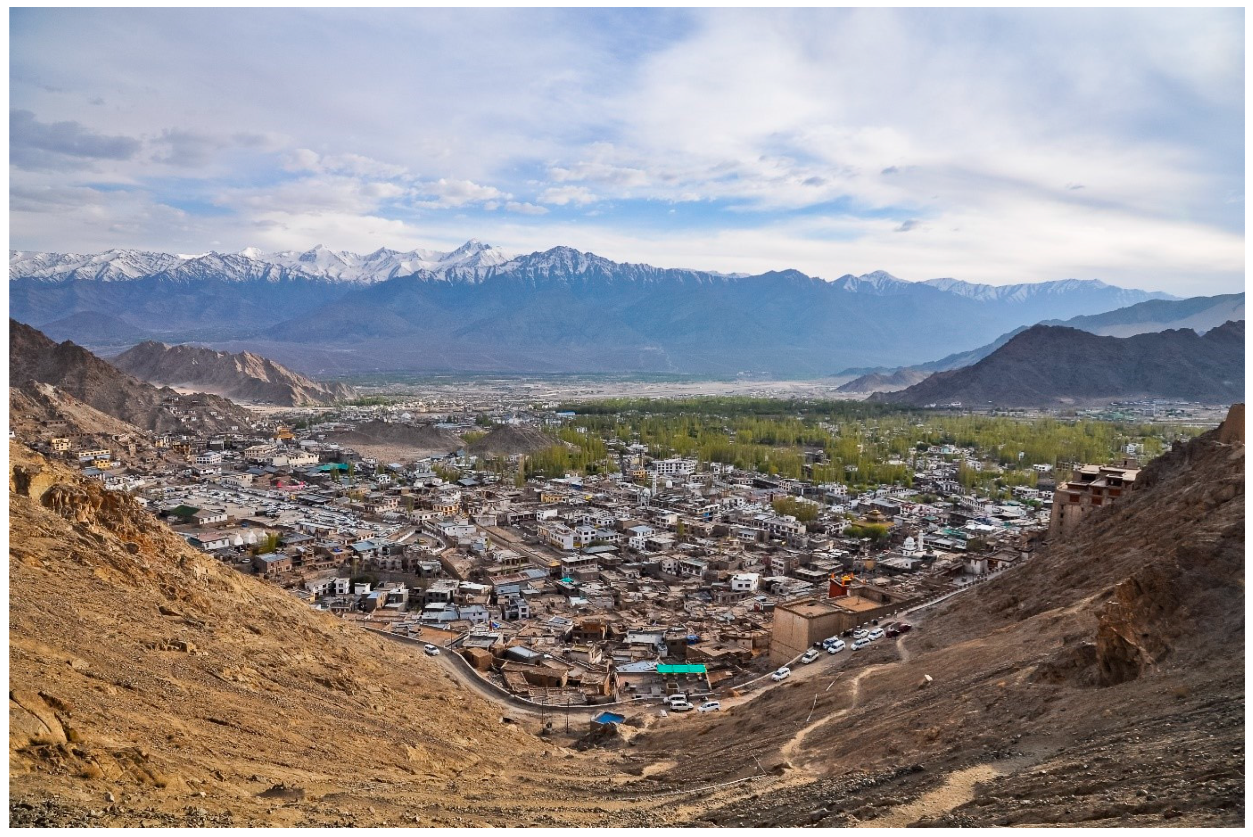
Projects READY2RESPOND Rapid Diagnostic in Uttarakhand and Himachal Pradesh Versión en español English version Share Facebook X (Twitter) LinkedIn Overview Anchor 6 Background Ready2Respond (R2R) is a rapid diagnostic guide, designed to improve national, sub-national and city resilience mechanisms and to protect development gains through investments in emergency preparedness and response systems. It is informed by the World Bank Group (WBG) City Resilience Program (CRP) and other WBG resilience platforms. In this project R2R is applied to the Uttarakhand and Himachal Pradesh states in the Himalayan region of India. The GEM Risk Team contributes to the project by providing: Literature review and stakeholder mapping around hazard and risk initiatives, risk data and models for both states Provision of seismic hazard/risk model outputs and related descriptive information for both states (to support diagnostic activities) Review of legal regulation of the built environment and associated initiatives Review of seismic preparedness of the critical infrastructure defined in the project Preparation and remote input into stakeholder workshops Duration: 2023 Objectives This project responds to the need to provide effective and comprehensive diagnosis of the Uttarakhand and Himachal Pradesh states’ emergency preparedness and response systems in the Himalayan region of India. This enables the World Bank and the government to tailor investments to strengthen institutional capacity and capability, ensure public safety, and limit economic disruption in the face of multiple, and often cascading, geological and hydrometeorological hazards. Collaborators GEM Foundation, JBA Consulting, Geo Climate Risk Solutions (GCRS) Funding partner: World Bank Group Location India Himalayas Anchor 1 Anchor 5 Anchor 4 Anchor3 Publications