top of page
bergamo-citta-alta-italy.webp

GEM Conference

Are we making a difference?

13th - 14th June 2023
Centro Congressi Bergamo
Bergamo, Italy

A Collective Success: Thank You!

Anchor 1

OVERVIEW

The recent devastating earthquake sequence that affected Türkiye and Syria reminded us again of the importance of our vision to reduce earthquake risk worldwide. This conference brought leading researchers and risk management experts worldwide together to discuss recent developments and future directions on the road to earthquake resilience.


The event featured sessions on GEM’s new global earthquake hazard and risk models, maps, and databases; applications to risk reduction and management; and the future of earthquake risk assessment science and practice.

speakers & panelists

Session Title

Speakers

presentations

GEM CONFERENCEAre we making a difference?

June 13th - 14th, 2023

Add to calendar

Presentation
Speaker
Organisation/Role
Lessons learned from the 2023 Kahramanmaraş, Türkiye earthquakes: Modeling aspects of insured portfolio losses
Sinan Akkar
Turk Reinsurance Inc., Principal Catastrophe Modeler (keynote speaker)
DASK National Insurance perspective of Turkey EQ
Ahmet Buğra Ceyhan
DASK, Claims and Catastrophe Project Management Specialist
Update of the Global Hazard Model
Marco Pagani
GEM Hazard Team Coordinator
Update of the Global Risk Model
Vitor Silva
GEM Risk Team Coordinator
Launch of the Earthquake Scenarios Database
Catalina Yepes
GEM Seismic Risk Engineer
Canadian Earthquake Risk Model
Tiegan Hobbs
Natural Resources Canada (NRCan), Research Scientist
Colombia Earthquake Hazard model + Cali
Miguel Mora
I+R Consultores en Ingeniería y Riesgos, Seismic Risk Engineer
Site-specific seismic hazard assessment for nuclear and hydropower facilities in France
Paola Traversa
Electricité de France (EdF), Seismologist
Triggered or secondary effects: Tsunami
Stefano Lorito
Istituto Nazionale di Geofisica e Vulcanologia (INGV), Researcher
Triggered or secondary effects: Liquefaction
Ellen Rathje
University of Texas at Austin, Geotechnical Engineering, Professor
Triggered or secondary effects: Landslide
Farrokh Nadim
NGI – Norwegian Geotechnical Institute, Technical Director
Incorporation of NASA products in global hazard and risk assessment
Shanna McClain
NASA, Disasters Program Manager
Keynote Lecture: International Macroseismic Scale
David Wald
United States Geological Survey (USGS), Research Geophysicist (Keynote speaker)
Systemic or cascading infrastructure risk
Astha Poudel
Aristotle University of Thessaloniki, Systemic Risk Researcher
Using GEM products to support rapid loss assessment
Alberto Michelini
Istituto Nazionale di Geofisica e Vulcanologia (INGV) ARISTOTLE, Director of Research
Future Exposure and Risk to natural hazards
Alejandro Calderon
GEM, Seismic Risk Engineer

Click the presentation title to download the PDF.

Program

POSTERS & Demos

Showcasing GEM Integration, Innovative Tools, and Advanced Data for Enhanced Hazard and Risk Assessment

Poster

TREQ Project Understanding earthquake risk at the urban and city levels

Alejandro Calderon

Seismic Risk Engineer

GEM

The Training and Communication for Earthquake Risk Assessment (TREQ) Project aimed to demonstrate how earthquake hazard and risk assessment can inform decision-making in risk reduction policies and how the risk can be properly communicated to stakeholders and the public. The project was divided into two parts, where the first aimed to develop capacity for urban earthquake hazard and risk assessment in three Latin American cities, and the second produced training, educational and communication material that enhanced the understanding of earthquake risk worldwide. The outcomes include 23 deliverables, 15 technical reports, 15 videos on technical training using the OpenQuake-engine, 7 videos with material to disseminate the models and results of urban risk assessment, and 2 videos for communicating earthquake risk to the general public. The models and results for urban hazard and risk assessment of each city are publicly available on a dedicated website. The project results demonstrated the importance of incorporating detailed information and local knowledge in earthquake hazard and risk assessment, with each city having models and results that reflect the potential impact that earthquakes can pose in a probabilistic and deterministic manner. The project also provided an online course on earthquake hazard and risk assessment, which covered four modules.

Poster

New Frontiers of Earthquake Model development: Aon Impact Forecasting and GEM partnership

Athanasios Gkimprixis

Earthquake Catastrophe Model Developer

Aon Impact Forecasting

Being one of the world’s deadliest natural hazards, earthquakes challenge experts from different fields to collaborate towards more accurate assessment of future seismic activity and guide risk management accordingly. Acknowledging this, Impact Forecasting - Aon’s catastrophe model development center of excellence – and Global Earthquake Model (GEM) have been closely collaborating for several years on the development of advanced tools to analyze the financial implications of earthquakes. A characteristic example of this powerful collaboration is the release of the new probabilistic loss models for earthquake risk assessment in Canada, EMEA and APAC. The Canada Earthquake model combines the sixth-generation hazard model implemented by Natural Resources Canada, utilizing GEM’s OpenQuake platform, with Impact Forecasting enhancements for secondary perils (liquefaction landslides, tsunami, fire). In Asia and Pacific region, the 2023 models provide most up-to-date earthquake risk view for Singapore and South Korea, considering general and detailed construction and occupancy classes, including high-value transportation (airport, seaport) and industrial facilities. The models consider local soil conditions, soil-structure interaction effects, and damage in glass facades, while the contribution of secondary perils (liquefaction, landslides) has been implicitly included. Next year, the Italy and Switzerland Earthquake models will be released, providing robust insights for re/insurers based on high-resolution and most up-to-date modelling. For this, Impact Forecasting in collaboration with the University of Strathclyde, Glasgow have developed a regional correlation model to simulate the spatial distribution of ground-motion fields in this region. The collaborative efforts to improve catastrophe models should be continuous, aiming to enhance earthquake risk understanding globally, increase the usage of earthquake models for client-based needs and solutions, and substantially reduce the catastrophe protection gap.

Poster

Leveraging and Improving GEM Tools to Model and Communicate Integrated Risk and Resilience to Earthquakes

Christopher Burton

Professor

University of Connecticut

How communities prepare for, respond to, and recover from the impacts of damaging hazard events is conceptualized in terms of their resilience. Communities that can increase their resilience are in a better position to absorb damage impacts and to recover from them when they occur. As a result, there is a strong interest in the measurement of disaster resilience as well as the integration of physical risk assessments with relevant socioeconomic metrics. The purpose of this poster is to present two timely projects aimed at showcasing the use of GEM tools and improving them. The first project focuses on improving the Integrated Risk Modelling Toolkit (IRMT). The purpose is to better understand which methods and modeling decisions are most appropriate for integrating physical earthquake risk assessments with quantitative metrics of social vulnerability (i.e., characteristics in social systems that create the potential for loss or harm). Here, Monte-Carlo based Sensitivity (SA) and Uncertainty Analysis (UA) is being utilized to inform integrated physical risk and social vulnerability modelling decisions. This project will also include the development and application of stakeholder needs and usability surveys to better understand how to best demonstrate and communicate coupled risk and social vulnerability assessments. The second project is a case study that employed the GEM Resilience Performance Scorecard (RPS) for an innovative use. The methodology includes the identification of context-specific characteristics that drive the resilience of businesses to tropical cyclones. The RPS was modified to measure gaps in the resilience of small businesses along the Mississippi and Alabama Gulf Coast (USA), and the modified RPS was sent as a survey to nearly 9000 coastal businesses to understand gaps in the resilience of businesses by industry type. With improved integrated risk and resilience methods, metrics, and tools, our vision is to provide governments, risk managers, community and business leaders, and researchers new opportunities to create initiatives to increase the capacity of communities to mitigate, respond, and recover effectively from damaging hazard events.

Demo

Interactive earthquake demo, simulating how Safehub sensors work using a K'NEX Building Model

Andy Thompson

CEO and Co-Founder

Safehub

This demo presents the innovative solutions offered by Safehub Inc., a technology company headquartered in San Francisco. Safehub's cutting-edge technology combines internet-connected sensors, a robust data analytics platform, and an effective alert system to deliver real-time building-specific damage estimates in the aftermath of disasters. By leveraging this technology, organizations can rapidly assess the severity of damage caused by events like earthquakes, enabling them to efficiently allocate resources for emergency response and mitigate potential disruptions to business operations.

Demo

GEM Foundation Global Interactive Maps

Paul Henshaw

Director of Technology and Development

GEM

Paul Henshaw with Matteo Nastasi presents the forthcoming release of interactive maps that offer a unique perspective on the changes in global earthquake hazard and risk between 2018 and 2023 presented at the GEM Conference. These maps, soon to be accessible to the public, provide dynamic comparisons and insights into the evolving nature of seismic risk worldwide.

Poster

Exploring new data analysis techniques on an extended earthquake catalogue for evaluating seismic hazard in Europe

Jochen Woessner

Senior Principal Modeller

Moody’s RMS

Earthquake catalogues are a crucial resource for most seismological investigations and form the foundation of every probabilistic seismic hazard assessment (PSHA). This paper presents new developments in processing and analyzing an updated European earthquake catalogue for PSHA purposes. The updated catalogue expands on the work of the 2020 European Seismic Hazard Model (ESHM20) and now covers the period from 1000 to the end of 2021, contributing with an additional 4,500 revised earthquakes with magnitudes greater than 3.5 in the region. Using this dataset, we test various state-of-the-art procedures for analyzing spatial patterns, magnitude distributions, and seismicity rates. In particular, we explore the use of Machine Learning (ML) techniques to address long-standing problems, such as earthquake declustering. We introduce a new objective tectonic classification methodology that improves on current standards and enables the grouping of previously unclassified events via an iterative clustering approach. This work lays the foundation for creating a new standardized workflow for developing the next generation of the Moody’s RMS European seismic hazard model.

Poster

Applications of Global Economic Disruption Index (GEDI) in Multi-Hazard Disaster Response, Mitigation and Planning

Shubaroop Ghosh

Vice President of Data Services

ImageCat

Risk models fail to answer: "How long will it take to get back to normal?" Emergency managers, businesses, and the general public need an effective, simple metric to communicate potential economic disruption and restoration. A novel approach of predicting economic impact from Earth Observation (EO), catastrophe models, and economic modelling was envisioned as a potential way to bypass the complexity of traditional modelling technologies and provide a simple index for widespread use. A GEO Google Earth Engine award and support from the NASA Disasters program provided an opportunity to use cloud based EO technologies for rapid processing and output generation. The resulting modelling framework produced the "Global Economic Disruption Index" (GEDI) that characterizes economic disruption, restoration, and possible impacts on critical infrastructure. GEDI is multi-hazard and can be applied with all major hazard data including earthquake, hurricane, and climate change data. GEDI has potential applications in multi-hazard advisories, prioritization of mitigation and adaptation strategies, and identification of extreme risks to infrastructure including potential supply chain disruption. GEDI has been tested for several major hurricane events using data from commercially sourced historic event catalogues. GEDI predictions for economic disruption for several hurricanes in the United States were validated using historic data on damage and losses from various reports and records. Major risk from wind and surge was forecasted using GEDI as hurricane Ian approached the coast of Florida in the United States. A GEDI score of three (III) was predicted based on Ian’s track and intensity forecasts. A GEDI score of III means that economic recovery may require weeks, with dire consequences for some vulnerable small businesses. Interruption in services may occur, primarily impacting the local economy, but major damage is expected to critical infrastructure such as the electrical supply, water supply, telecommunications, sanitation, or fuel supply. GEDI has also been applied to earthquake events. Recently, a GEDI score of five (V) was computed for the two earthquake events that struck Turkey and Syria, the Kahramanmaras M7.8 event and the M7.5 aftershock to the northeast using USGS ShakeMap ground motion estimates. A GEDI score of V indicates catastrophic impacts with major disruption in economic activity that may require years of recovery. Additional applications of GEDI include advisories for typhoons and risk from a 100-year flood in India, hindcasting of U.S. hurricane impacts, and global future risk to coastal flooding and sea level rise.

Demo

Multi-hazard risk assessment and mapping in West Bank & Gaza using GEM standards, models, tools & technologies

Jamal Dabbeek

Professor

An-Najah National University

The Integrating Resilience in Local Governance (IRLG) in West Bank and Gaza project was funded by the Municipal Development and Lending Fund (MDLF) and implemented by the Urban Planning and Disaster Risk Reduction Center (UPDRRC) at An-Najah National University. The objectives of the project were to lay the foundation for integrating resilience in local governance through the production of technical knowledge, information and guidelines, and the development of the corresponding institutional capacity. One of the key tasks in this regard has been to conduct a “Multi-Hazard Risk Assessment and Mapping”, and a web-based mapping platform, developed using GEM’s geoviewer technology, was produced to present the main results. Geophysical hazards (earthquakes, liquefaction, landslides), climate change hazards (extreme temperatures and rainfall) and hydrological hazards (flooding and flash flooding) were considered. Exposure to these hazards has been assessed by modelling (using GEM standards) the spatial distribution of: residential, commercial and industrial buildings and their occupants; schools, hospitals, municipality and civil defence buildings and their occupants; other critical infrastructure related various sectors; agricultural land. Seismic risk, flood risk and climate change risk for these assets has been computed by combining the hazard and exposure with social and physical vulnerability models and indices (using, in the case of seismic risk, GEM’s OpenQuake engine).

Demo

NEEV a digital platform to remote resilience and sustainability within low income Communities

Marco Ferrario

Co-Founder

MHS Global Impact

Developed by mHS, NEEV is both a web and mobile app specifically designed to support all the stakeholders working in the incremental housing context. Its simple interface allows people with no technical background to create construction technical documents and share knowledge. NEEV has been developed to empower vulnerable communities to increase their resilience to natural risks and capacity to adapt to climate induced shocks, while influencing the quality and efficiencies of the buildings.

Demo

RiskProfiler.ca Sharing earthquake risk assessment results in Canada

Malaika Ulmi

Public Safety Geoscience Program Manager

NRCan

In 2022, Natural Resources Canada’s Geological Survey of Canada published a national seismic risk model at the neighbourhood level for Canada, using GEM’s OpenQuake application and working with GEM scientists. The results of the probabilistic model and a suite of scenarios has been made public via www.riskprofiler.ca, a platform that allows users to explore the model results and potential impacts for their jurisdiction. It includes maps and charts, as well as a toggle that allows users to consider the impact of retrofit measures. This platform is intended to support those in the planning, insurance, engineering, and emergency management sectors in Canada to make informed risk reduction decisions. This live demonstration will share the functionalities of the platform.
Posters
Hotel Exterior
Image by Kir Shu
Image by Michael Sala

Location

Top Attractions

bergamo top attactions.png

Transportation

TRANSFERS FROM BERGAMO AIRPORT TO BERGAMO
https://www.atb.bergamo.it/en/atb-network/tourism-in-bergamo/airport-bus

BERGAMO AIRPORT WEBSITE
https://www.milanbergamoairport.it/en/

ORIOSHUTTLE (FROM MALPENSA AIRPORT TO BERGAMO ORIO AL SERIO AIRPORT)
http://www.orioshuttle.com/_eng/

CAPITAL OF ITALIAN CULTURE FOR 2023
https://bergamobrescia2023.it/en/

resources

Conference resources for downloading

Videos

Galleries

Maps

Recording

Resources

Videos

A series of video clips capturing some of the reactions to the release of GEM's new earthquake hazard and risk maps, models, and database including demos of innovative tools, and advanced data for enhanced hazard and risk assessment. Watch on YouTube to read the video description.

2023 GEM Conference: video clips

2023 GEM Conference: video clips

2023 GEM Conference: video clips
John Schneider GEM

John Schneider GEM

03:43
Play Video
Sonia Talwar NRCan

Sonia Talwar NRCan

01:07
Play Video
Shanna McClain NASA

Shanna McClain NASA

03:14
Play Video
Sinan Akkar Turk Insurance Inc.

Sinan Akkar Turk Insurance Inc.

06:34
Play Video

Galleries

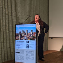
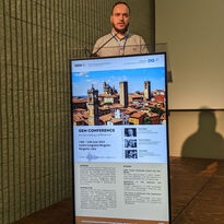
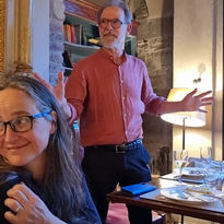
GEM2023 in Photos:

By GEM
By Andrea Mini
By Jill Dobkin

Photo credit: GEM

Recording

Day 1, June 13th, 2023 Introduction and Session 1

Day 2 June 14th, 2023, Sessions 2 and 3

bottom of page